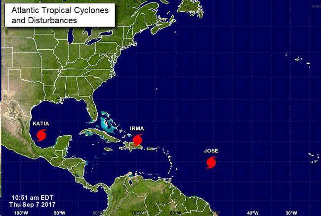
Hurricane watches could be posted for South Florida as early as Thursday, as the latest forecast showed a growing risk from one of the strongest Atlantic hurricanes in history.
A hurricane watch, which is typically issued 48 hours before the storm hits, means hurricane conditions are considered possible within that time frame. If they are considered likely, the condition is upgraded to a hurricane warning.
Miami-Dade County ordered evacuations to start Thursday morning in Miami Beach and other barrier islands, as well as evacuation zone A, which encompasses low-lying coastal neighborhoods on the mainland. Broward County ordered coastal and low-lying neighborhoods evacuated Thursday, with 14 shelters opening at noon.
At 2 a.m. Thursday Irma remained a Category 5 storm with winds of 180 mph —down 5 mph from 11 p.m. Wednesday— as it headed to the northeast of the Dominican Republic.
The question for South Florida is where that turn will take place. If the hurricane veers right soon enough, it could rake the Bahamas but avoid a direct strike on Florida. It could turn later and go up the Gulf coast or it could buzz right up the South Florida coast, putting millions of people in the path of a once-in-a-generation hurricane.

